|
PENGENALAN
Geomatic has become one of the tremendous government tools and instrument in stimulating physical, economic and social development growth at the national and international level. The new state-of-the-art technology and up-to-date knowledge are competencies and skills needed for the semi professional land surveyor to generate future development scenario in land development project, marine development, agro-echnology, geospatial industry, geological and geophysical activities.
The emphasis of Polytechnic Diploma programme through theoretically subjects and practical method such as lectures, tutorials, assignments, field works, laboratory works, survey camp and industrial training at land surveying firms, engineeringmconsultant firms, local authorities and various government departments are provided to penetrate employment market with supporting skills such as technical skills and soft skills. This will give the students some added value which are relevant to the requirement of Licensed Land Surveyors Board (LJT), Royal Institution of Surveyors Malaysia (RISM) and Department of Survey and Mapping, Malaysia (JUPEM). The accreditation from the Royal Institution of Surveyor Malaysia (RISM), Licensed Land Surveyors Board (LJT), related universities, government departments and Licensed Land Surveyors Consultant firm is the important requirement in order to complete the curriculum development process.
SYARAT KEMASUKAN
Untuk maklumat lanjut berkenaan syarat kemasukan ke Politeknik Merlimau (Politeknik Konvensional) Klik sini
http://www.politeknik.edu.my/portalbpp2/index.asp?pg=politeknik
PROGRAMME AIMS
The Diploma in Geomatic graduates in Polytechnics, Ministry of Education will have knowledge, technical skills and attitude to adapt themselves with new technological advancement and challenges in geomatic fields.
PROGRAMME EDUCATIONAL OBJECTIVES (PEO)
The Diploma in Geomatic programme shall produce semi professionals who are:
1. knowledgeable, technically competent in geomatic discipline and able to adapt themselves with new technological advancement and challenges in geomatic fields.
2. effective in communication and social responsibilities, able to become a leader and work as a team.
3. practicing good work ethics, able to promote good morality and behaviour and will continuously enhance their knowledge and skills.
4. able to solve managerial and field problems and possess entrepreneur skills to prepare themselves for future challenges.
PROGRAMME HANDBOOK
Klik Sini.
PROSPEK KERJAYA
Peluang pekerjaan pelajar selepas menamatkan pengajian dengan Diploma Geomatik adalah seperti berikut:
• Assistant Surveyor
• Assistant Land Officer
• Land Survey Site Supervisor
• Land Survey Draughtsman
• Assistant Hydrographic Surveyor
• Assistant Information System Officer (GIS)
• Assistant Information System Officer (Remote Sensing)
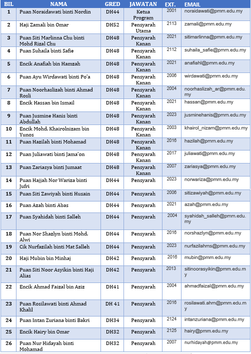
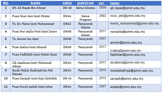
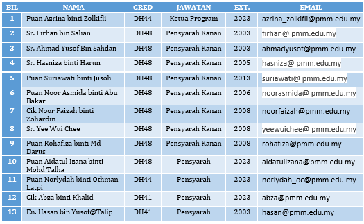
SENARAI PENSYARAH PROGRAM DIPLOMA GEOMATIK
 |

